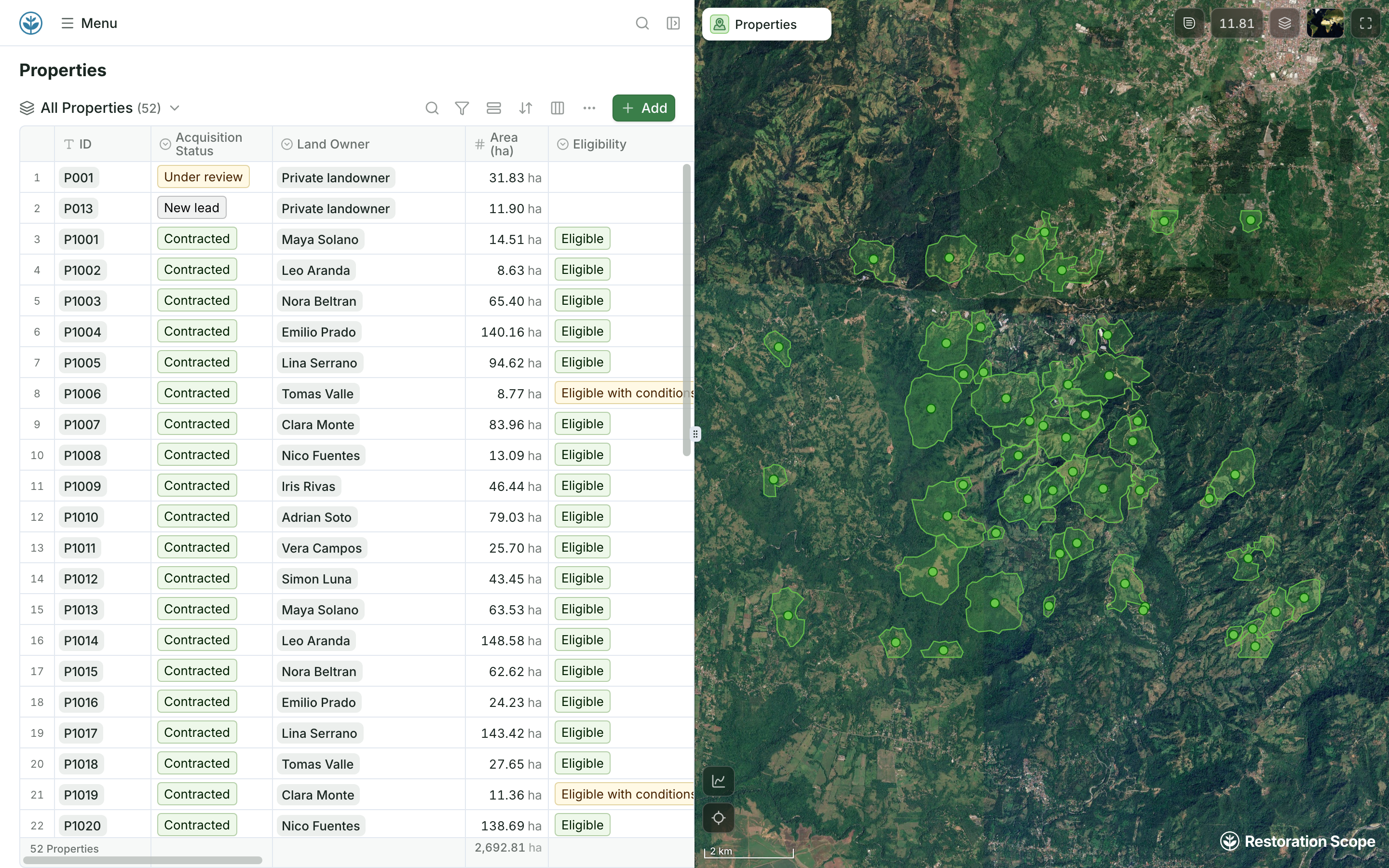
A table that is also a map
The rows a sheet would hold, each beside its boundary on the map.
Many nature restoration projects keep their records in Excel or Google Sheets, and the two are not equal. Excel files kept on laptops get emailed, copied and lost, and nobody knows which copy is current. A Google Sheet is one shared file with version history: move the Excel files there. Even a shared sheet is not built around maps. Sites become latitude and longitude columns, boundaries live in separate files and photos sit in folders. Restoration Scope keeps those records on a map of sites and polygons, and keeps reading your Google Sheet.
 Restoration Scope
Move Excel files to a shared Google Sheet first. For most projects past a first site and season, Restoration Scope is the better home: it keeps sites and polygons on a map, ties repeat survival checks to the right planting, gives several partners one record and funders maps and photos by site, and keeps reading your Google Sheet. A Google Sheet is enough for one site, one season and one or two people, while you work out what to track.
Restoration Scope publishes this comparison and is one of the options. We list it first because we think it's the best fit for most projects: it adapts to each project and grows with it, and covers operations and costs as well as fundraising and reporting. No vendor paid to be included. Something out of date? Write to info@restorationscope.com.
| Restoration Scope |   Excel and Google Sheets | |
|---|---|---|
| What it is | The system that runs a nature project: sites, field work, surveys, maps, results and funder reporting. The field app and its surveys are part of it. | General-purpose spreadsheets: tables, formulas, charts and pivot tables, on the web, desktop and phones. |
| Cost | A free pilot on a sample of your data, then a platform license plus implementation, quoted after a scoping call. | Google Sheets is free with a Google account. Excel comes with Microsoft 365, and Excel for the web is free with a Microsoft account. Many teams already have one. |
| Sites on a map | Every site, plot and planting on one project map, in the browser and Restoration Scope Field. | Coordinates sit in two columns. Excel's map chart and Sheets' geo chart shade regions or mark named places, not latitude and longitude pairs; Excel's 3D Maps, on Windows, can plot points. To work with sites on a map, teams usually copy rows into another tool, such as Google My Maps. |
| Boundaries and GIS files | Points, lines and polygons drawn or walked on the project map, saved to their site. Shapefile, GeoJSON, KML and KMZ files come in and attach to their sites. | No shape type in a cell. Polygons are pasted as text or kept as separate KML, GeoJSON or shapefiles; Excel's 3D Maps can import KML or shapefile regions to map data onto. Neither app checks that a shape is valid or still matches its row. |
| Photos | Attached to the record, with place and time. | Images in cells, links to shared folders, or chat messages. The sheet does not read where a photo was taken. |
| Field capture | Restoration Scope Field works offline: points, lines, polygons and photos. | Often typed in after the visit, or fed by a form such as Google Forms or Microsoft Forms. Neither form tool has a question that records a GPS point or boundary. |
| Sharing and seasons | One current record per site, linked to every visit, season after season. | Emailed Excel files drift apart; a Google Sheet stays one shared file with version history. Survival checks still become a tab per season, joined by lookup formulas on site IDs you keep in sync. |
| Funder and verifier reporting | Donor portals built from the same records the team keeps. | Charts and pivot tables, then maps, photos and boundary files often put together by hand for each report. |
Google SheetsThe team keeps one shared Google Sheet, not Excel files.Restoration ScopeRestoration Scope keeps syncing as the sheet changes.Restoration ScopeIts rows join the project's records and map.Restoration Scope connects Google Sheets and keeps syncing as the sheet changes, so the sheet can stay where it works. Excel files come in once, as imports, so move them to Google Sheets first.
Checked against their makers' own pages on October 18, 2026: Excel map charts, Excel 3D Maps, 3D Maps custom regions, Excel for the web, Google Sheets, Sharing from Drive, Version history, Shared drives, Sheets geo charts, Google My Maps imports, Google Forms question types, Microsoft Forms questions.
These are Restoration Scope screens from our demo project and a public donor portal. To see Excel and Google Sheets, visit their own sites: Microsoft Excel and Google Sheets.
The rows a sheet would hold, each beside its boundary on the map.
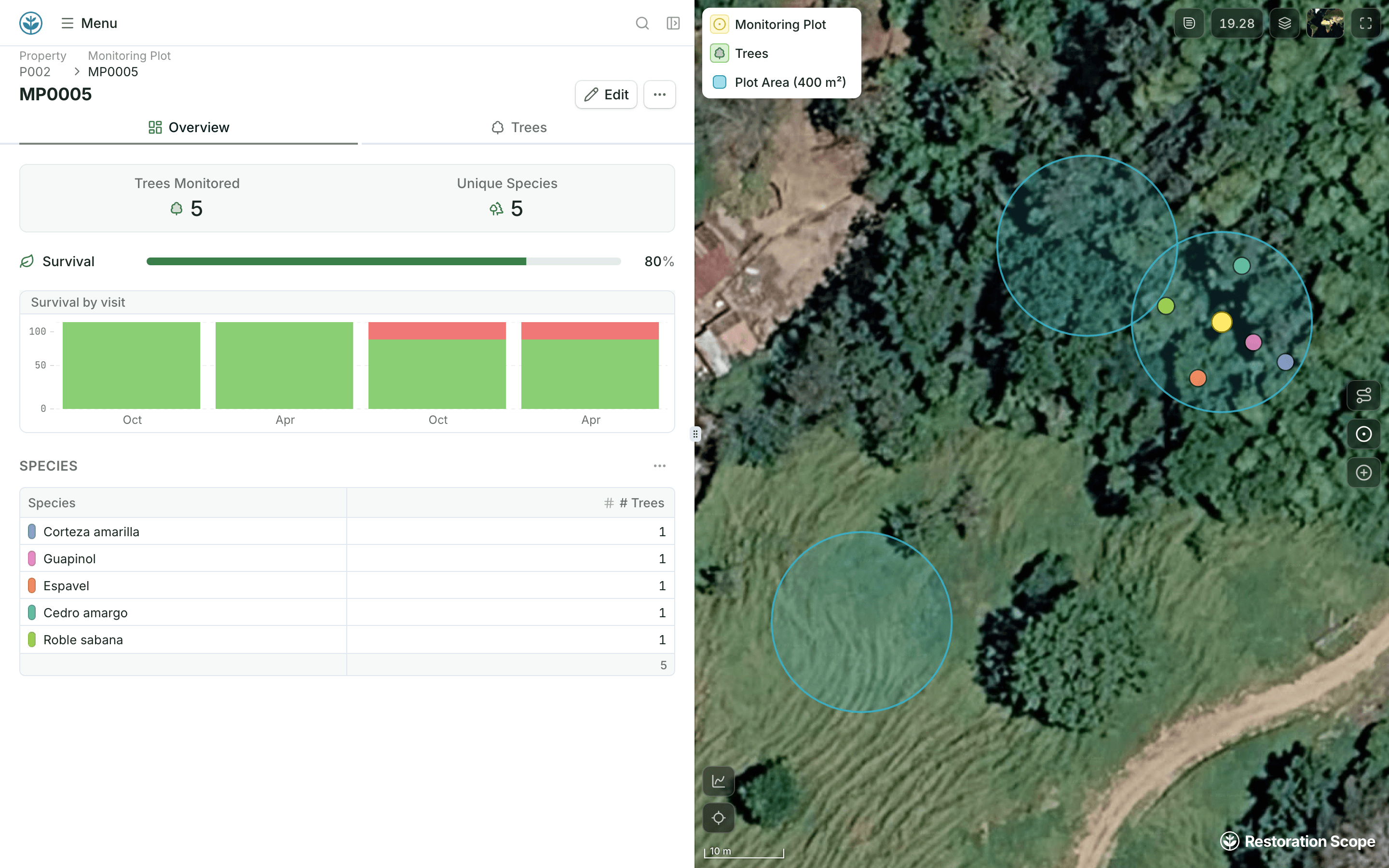
A site keeps its boundary, monitoring plots and survival rate together, so nobody joins tabs by hand.
Excel files and Google Sheets cover three levels, from files sent by email to linked sheets with scripts. Google Sheets is where records become workable. Restoration Scope is an adaptable platform that connects to your sheets instead of replacing them.
Where restoration records live, from word of mouth to custom softwareOf regions, yes: Excel's map chart and Sheets' geo chart shade countries, states or regions, and Excel's 3D Maps, on Windows desktop, can plot points. For sites with boundaries, teams usually copy rows into Google My Maps, which takes up to 2,000 rows per imported file, or into a GIS such as QGIS.
Keep latitude and longitude in decimal degrees, in separate columns, then import the file into a mapping tool: Google My Maps, QGIS, or Restoration Scope, where each row becomes a site on the project map. If your coordinates are in UTM, our free UTM to Lat/Long Converter changes them first.
For running a restoration project, yes: Restoration Scope covers what spreadsheets were not built for, such as sites and boundaries on a map, photos tied to places, and survival checks tied to the right planting. For budgets, quick lists and analysis, keep the spreadsheet.
For most projects, neither: a ready platform such as Restoration Scope gives you the fit of custom software without hiring a team, and keeps reading your Google Sheet. Spreadsheets are enough for one site and one season. A custom build makes sense only when software is your project's edge and you can fund at least two developers for years; our guide to building an in-house software team covers the costs.
Another question? Email us or book a call.
Bring in the spreadsheets, field forms and maps you already use, and see every site in one place.
