Land and landowners in the same system
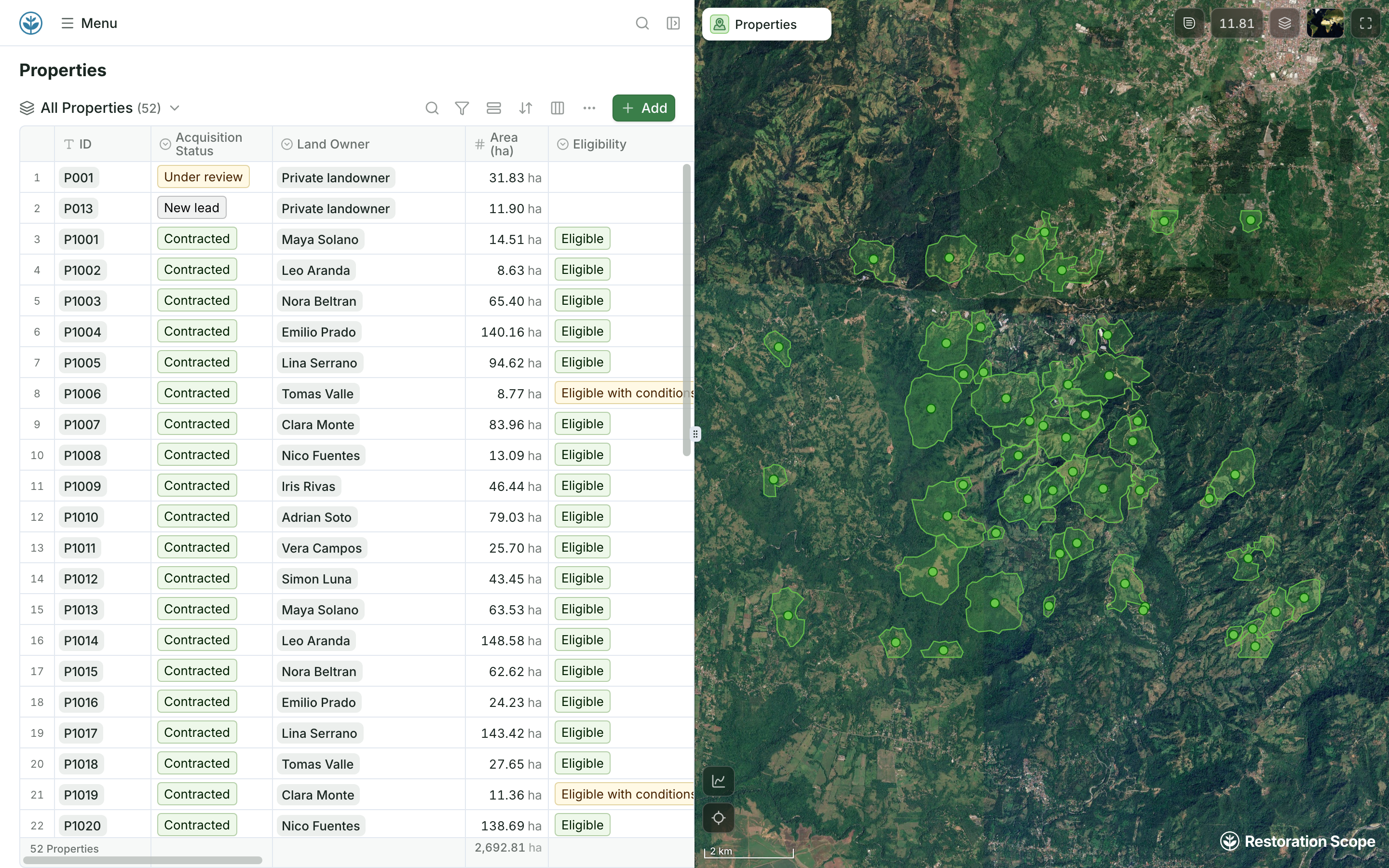
Properties carry their acquisition status, landowner, area and eligibility, next to their boundaries on the map.
Restoration Scope runs the work on the ground: land and landowners, field teams, plots and monitoring, configured around your project and grown with it. BlueLayer is software for carbon project developers: project management, the credit lifecycle from estimate to retirement, sales to buyers, and a dMRV module that turns operational data into verification reports.
 Restoration Scope
They solve different problems. To run land and forest projects on the ground, with land agreements, field teams working offline and plots revisited every season, Restoration Scope is configured around that work; BlueLayer’s site describes field data for biochar operations, not forest plots. For the credit business, forecasting issuance, tracking inventory and contracts, selling to buyers, BlueLayer is built for that and Restoration Scope does not do it.
Restoration Scope publishes this comparison and is one of the options. We list it first because we think it's the best fit for most projects: it adapts to each project and grows with it, and covers operations and costs as well as fundraising and reporting. No vendor paid to be included. Something out of date? Write to info@restorationscope.com.
| Restoration Scope | ||
|---|---|---|
| What it is | A restoration data platform configured around your project: land and landowner records, a field app, monitoring, maps and portals. | Software for carbon project developers, with four products: project management, credit management, a revenue engine for sales, and dMRV. |
| Cost | A free pilot on a sample of your data, then a platform license plus implementation, quoted after a scoping call. | Not published. Demos on request. |
| Credits and sales | Not covered. We don’t issue, track or sell credits; pair us with a credit tool or your registry. | Its core: the credit lifecycle from estimation and verification to delivery and retirement, with inventory and forecasts synced to offers and contracts, and sales across channels. |
| Field data | Restoration Scope Field works offline: field teams record surveys, photos and planting areas on the same property maps the office sees. | Its dMRV module brings in data from systems, sensors and devices, and a case study describes an offline mobile companion app for biochar field teams. Its site does not describe forest plot inventories. |
| Land and landowners | Parcels, landowners and eligible area, moving through a pipeline from first conversation to contract. | Its site does not describe parcels, landowner records or land agreements. |
| Maps | Sites, plots and boundaries on a satellite map. Boundaries download as GeoJSON or KML. | Its product pages do not describe maps or project boundaries. |
| Verification | Plots, trees and observations kept across seasons, so each number traces back to its records. We don’t prepare registry submissions. | Monitoring reports and audit-ready data for registries, buyers and verifiers, audit logs, and reports sent to digital-first registries by API. |
| Connections | Kobo, Google Sheets, spreadsheets and GIS files in the same system. | Registries, CRMs, accounting software and ERPs, through an API. |
Checked against BlueLayer's own pages on October 19, 2026: BlueLayer, Project management, dMRV, LongStraw case study.
These are Restoration Scope screens from our demo project and a public donor portal. To see BlueLayer, visit its own site.
Properties carry their acquisition status, landowner, area and eligibility, next to their boundaries on the map.
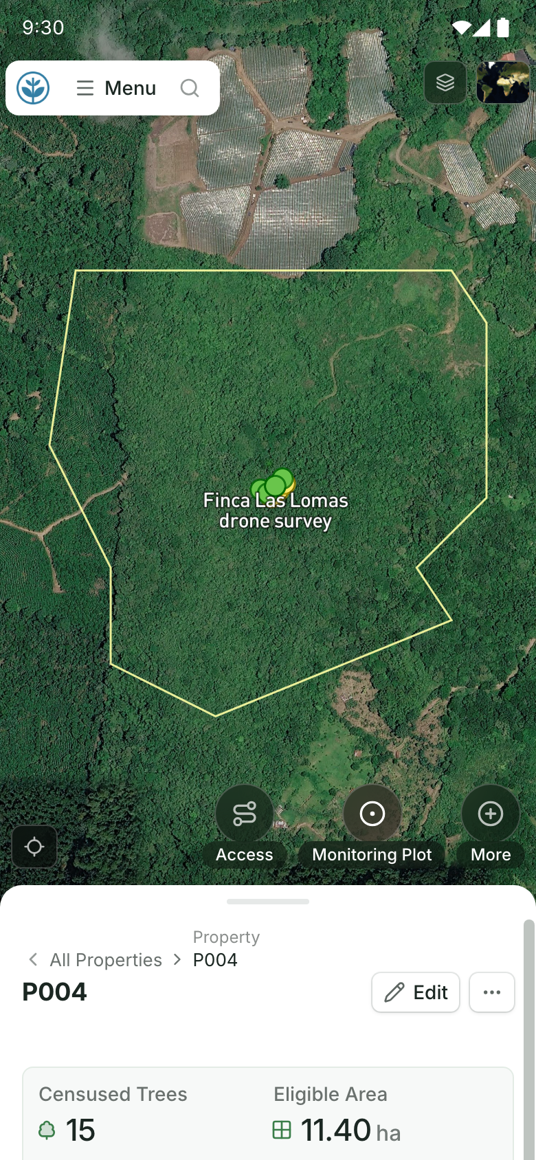
Field teams open the property on their phones: its boundary on the map and its record below.
BlueLayer is carbon software covering the credit lifecycle, from estimate to retirement. Restoration Scope is an adaptable platform for the land and field records underneath, configured around each project.
Where restoration records live, from word of mouth to custom softwareYes, for some workflows. A July 2026 case study describes an offline mobile companion app that biochar field teams use to send inputs to its dMRV module. Its site does not describe forest plot inventories. Restoration Scope Field records surveys, photos and planting areas offline, on the project’s property maps.
No. We don’t issue, track or sell credits, and we are not a registry or a verifier. BlueLayer covers the credit lifecycle; Restoration Scope keeps the land, field and monitoring records behind the credits.
BlueLayer does not publish prices; it offers demos on request. Restoration Scope offers a free pilot on a sample of your data, then quotes a platform license plus implementation after a scoping call.
Only in part. For land, field operations and monitoring records, yes. For credit inventory, contracts and sales, no: that is BlueLayer’s core, and we don’t do it.
Another question? Email us or book a call.
Bring in the spreadsheets, field forms and maps you already use, and see every site in one place.