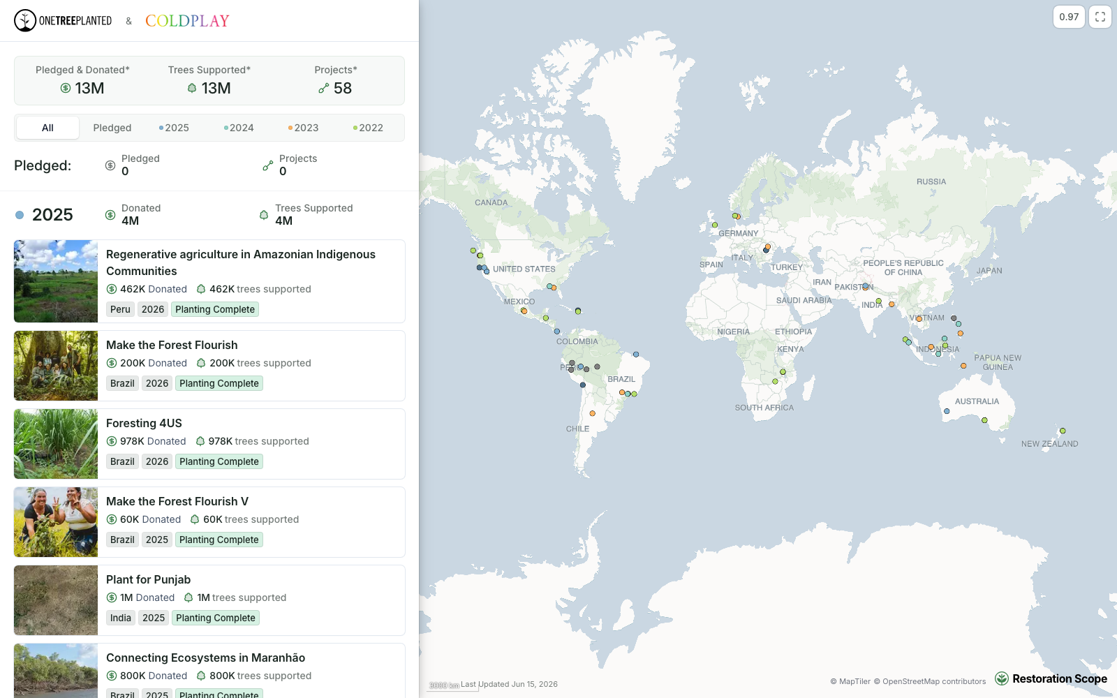
A portal fed by the work
Each funder's portal shows the projects they support, from the records field teams keep.
Restoration Scope builds donor portals from the records field teams keep, in the same system that runs the project, so what donors see is the work itself. explorer.land lets nature projects publish a map-based page that tells their story to funders, with a free plan to start.
 Restoration Scope
For most projects, Restoration Scope: donors see what field teams recorded, with no separate reporting step, and the same records run the sites, partners and field work, from one project to a multi-partner programme. For a public project page you set up yourself, for one or a few projects told as a story, explorer.land is the quicker start, with a free plan.
Restoration Scope publishes this comparison and is one of the options. We list it first because we think it's the best fit for most projects: it adapts to each project and grows with it, and covers operations and costs as well as fundraising and reporting. No vendor paid to be included. Something out of date? Write to info@restorationscope.com.
| Restoration Scope | ||
|---|---|---|
| Main job | An operational system. Donor portals are one view of the same data. | A public, story-led project page to show work and attract funding. |
| Cost | A free pilot on a sample of your data, then a platform license plus implementation, quoted after a scoping call. | As of October 2026: free for 1 project, 1 site and 2 editors. Starter is €49 and Professional €99 per project a month (€34 and €69 billed yearly); Enterprise is by quote. |
| Setup | Configured with our team. | Self-serve sign-up. Draw or upload boundaries on satellite base maps. |
| What donors see | Sites, progress and records from field teams, per donor or programme. | A project map, geolocated news posts, SDG tags and partners. |
| Where the data comes from | What field teams capture, plus connected Kobo, Google Sheets and GIS files. | What editors post, draw or upload: news posts, boundaries and geodata imports, with API and partner data on Enterprise. |
| Field monitoring | Restoration Scope Field, the offline field app, with visits and survival records linked to each site. | A mobile app in every plan. Monitoring centers on satellite indicators and an impact dashboard that can take in field data; Enterprise adds integrations such as sensors. |
| Satellite and layers | Geospatial data layers per project. | High-resolution imagery from Starter. Custom layers and geoanalytics on Enterprise. |
| Funding routes | None. We do not match funders or sell credits. | Lists investments, sponsorships, donations, and carbon and biodiversity credits. |
Checked against explorer.land's own pages on October 17, 2026: explorer.land, Plans overview, Platform, What we offer, Base maps.
These are Restoration Scope screens from our demo project and a public donor portal. To see explorer.land, visit its own site.
Each funder's portal shows the projects they support, from the records field teams keep.
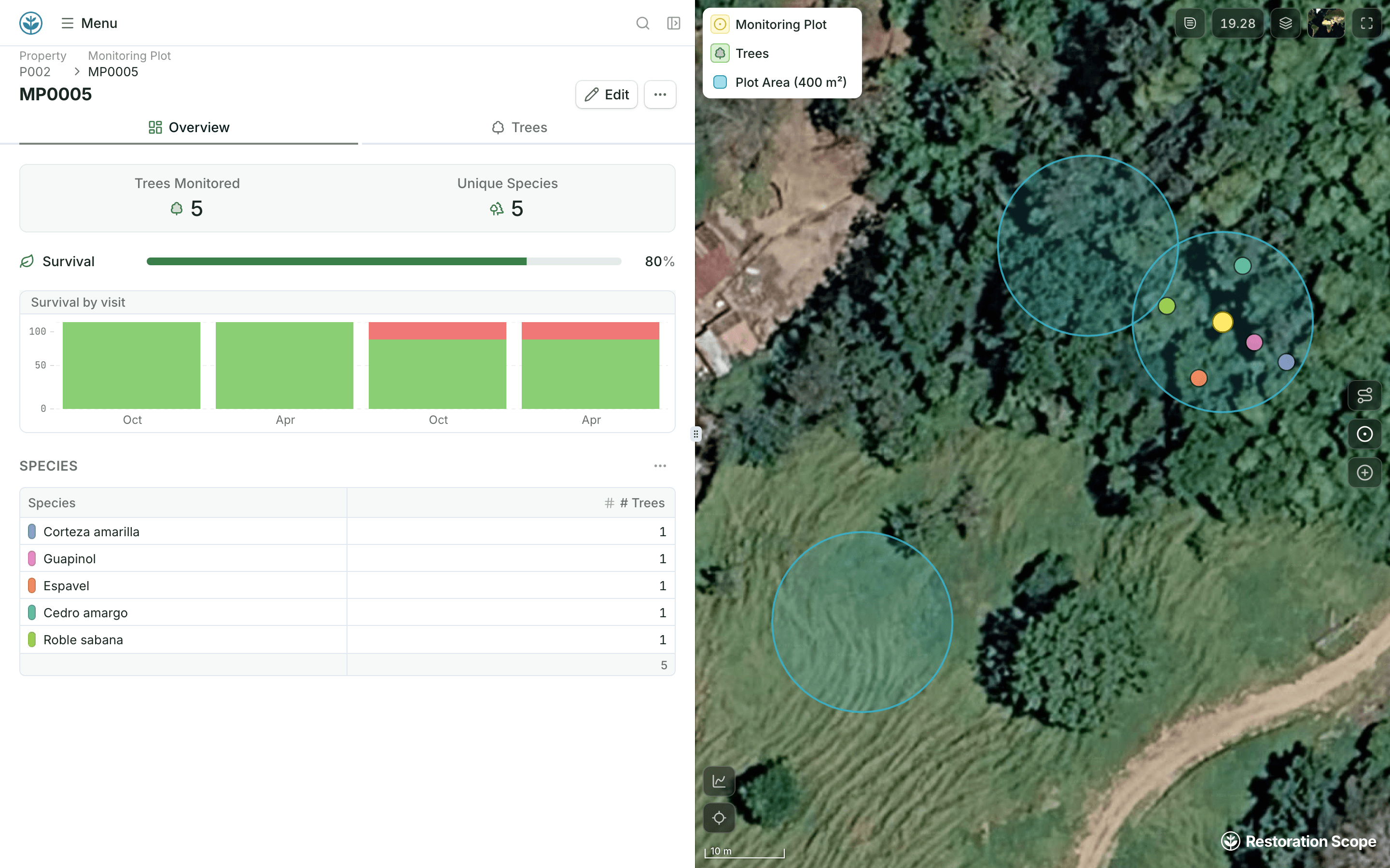
Visits, plots and survival records sit on the site they belong to.
explorer.land sits beside the ladder: it publishes a project’s map, monitoring and story for funders. Restoration Scope is an adaptable platform, and its donor portals show the records the team keeps.
Where restoration records live, from word of mouth to custom softwareFor donor reporting that should come from operational records, yes. For a public story page you set up yourself, explorer.land is the quicker start, with a free plan.
As of October 2026, it is free for one project with one site. Paid plans are priced per project per month, from €34 billed yearly.
In Restoration Scope portals, yes: donors read the same records the team keeps. The One Tree Planted portal for Coldplay is a public example.
explorer.land lists funding routes, including credits. Restoration Scope does neither.
Another question? Email us or book a call.
Bring in the spreadsheets, field forms and maps you already use, and see every site in one place.
