
Seasons and survival, already linked
Each site holds its monitoring plots, visits and survival rate, configured for your project with our team, with no related tables to build.
Restoration Scope is configured around restoration and carbon work, so sites, plantings and monitoring visits stay linked, field teams work offline, and funders see the same records. ArcGIS Field Maps and Survey123 are Esri's field apps: Field Maps starts from a map, Survey123 from a form, and both keep their data in ArcGIS. For teams that already run ArcGIS, they are a strong choice.
 Restoration Scope
Pick Field Maps when the work starts from a map, and Survey123 when it starts from a form. Field Maps views and edits map layers in the field, offline on downloaded map areas; Survey123 is a smart form that also works offline, and its answers can carry a location. Teams can use both: a link in a Field Maps pop-up can open a Survey123 form. Restoration Scope's field app maps sites and fills surveys in one place, compared with both below.
For most restoration and carbon projects, Restoration Scope: it comes configured for the work, ties visits to sites season after season without a data model to build, and gives funders portals from the same records. If you already run an ArcGIS organization with someone to design its layers, forms and offline maps, Field Maps and Survey123 are mature, with strong high-accuracy GPS, and eligible nonprofits get 50–99% off. Layers exported from ArcGIS come in, so GIS work is not rebuilt.
Restoration Scope publishes this comparison and is one of the options. We list it first because we think it's the best fit for most projects: it adapts to each project and grows with it, and covers operations and costs as well as fundraising and reporting. No vendor paid to be included. Something out of date? Write to info@restorationscope.com.
| Restoration Scope |   ArcGIS Field Maps and Survey123 | |
|---|---|---|
| What it is | The system that runs a nature project: sites, field work, surveys, maps, results and funder reporting. The field app and its surveys are part of it. | Esri's field apps for ArcGIS Online or ArcGIS Enterprise. Field Maps, on Android and iOS, starts from a map; Survey123, on phones, Windows and the web, starts from a form. |
| Cost | A free pilot on a sample of your data, then a platform license plus implementation, quoted after a scoping call. | As of October 2026: annual licenses per user type, with no prices on Esri's buy page; on ArcGIS Online, storage and Survey123 reports use credits. Eligible nonprofits get 50–99% off. Editing in Field Maps needs a Mobile Worker license or higher, and building surveys a Creator; public Survey123 forms need no account. |
| Who sets it up | Configured with our team around your project. Someone on your side owns the workflow. | Someone with a Creator licence designs the layers, forms and offline map areas, in Field Maps Designer, the Survey123 web designer, or XLSForm in Survey123 Connect. |
| Offline capture | Restoration Scope Field works offline: points, lines, polygons and photos. | Both work offline once set up. Field Maps needs sync-enabled layers, then workers download a prepared area or pick their own. Survey123 forms work offline in its phone apps, apart from questions that look up online data. |
| GPS accuracy | Phone GPS, with accuracy warnings and jump filtering when walking boundaries. | Phone GPS, or external high-accuracy GNSS receivers. Field Maps saves each point’s accuracy when the layer has fields for it. |
| Seasons and survival | Sites, plantings and visits are linked records, configured for your project. | Field Maps keeps a history of inspections in a related table: start from a template that has one, or build it in ArcGIS Pro. You design and maintain the data model. |
| Donor reporting | Donor portals built from the same records the team keeps. | ArcGIS Dashboards and StoryMaps, which can be shared publicly, and Survey123 reports in Word or PDF, which use ArcGIS Online credits. |
ArcGIS Field MapsCrews collect in Field Maps and Survey123, and the data stays in ArcGIS.Restoration ScopeExported layers (Shapefile, GeoJSON, KML) come in and attach to their sites.Restoration ScopeField teams, coordinators and funders see them with the project records.Keep collecting in ArcGIS. Its layers, exported as Shapefile, GeoJSON or KML, come into Restoration Scope, so boundaries mapped in ArcGIS are not redrawn.
Checked against their makers' own pages on October 19, 2026: Field Maps, Field Maps requirements, Offline map areas, High-accuracy collection, Related tables for repeat reports, Survey123, Survey123 requirements, Survey123 FAQ, Opening Survey123 from other apps, Survey123 reports, Exporting layers, ArcGIS Online user types, Nonprofit Program, ArcGIS Dashboards, ArcGIS StoryMaps.
These are Restoration Scope screens from our demo project and a public donor portal. To see ArcGIS Field Maps and Survey123, visit their own sites: ArcGIS Field Maps and ArcGIS Survey123.
Each site holds its monitoring plots, visits and survival rate, configured for your project with our team, with no related tables to build.
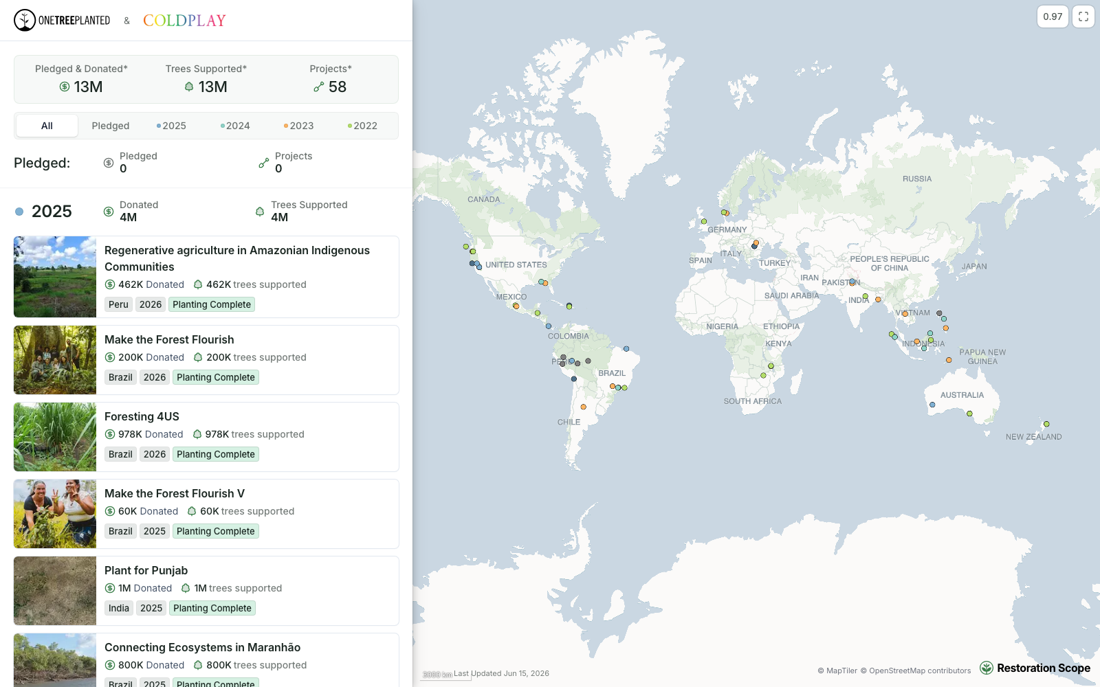
Each funder gets their own portal: their totals, then every project they support, kept current by the records the team keeps.
Field Maps and Survey123 are apps in the ArcGIS platform, which teams join with layers, dashboards and often spreadsheets into a network of tools they design themselves. Restoration Scope is an adaptable platform configured around restoration work, and it takes in ArcGIS layers.
Where restoration records live, from word of mouth to custom softwareFor running restoration field work and reporting on it, yes, without designing your own data model. For GIS itself, with analysis, cartography and enterprise deployment, ArcGIS is the full platform.
As of October 2026, ArcGIS Online is sold as annual licences per user type, and its buy page lists no prices. Editing in Field Maps needs a Mobile Worker licence or higher, survey authors need a Creator, and public Survey123 forms need no account. ArcGIS Online storage and Survey123 reports use credits. Nonprofits accepted into Esri's Nonprofit Program get 50–99% off.
Yes, to build and run them. Both keep their data in ArcGIS Online or ArcGIS Enterprise, so you need an ArcGIS organization and the right user types. People can fill in public Survey123 forms without an account.
Yes. Layers exported from ArcGIS as Shapefile, GeoJSON or KML come in as map layers and attach to the sites they describe, beside spreadsheets and survey forms.
Another question? Email us or book a call.
Bring in the spreadsheets, field forms and maps you already use, and see every site in one place.