Sites and boundaries, not pins
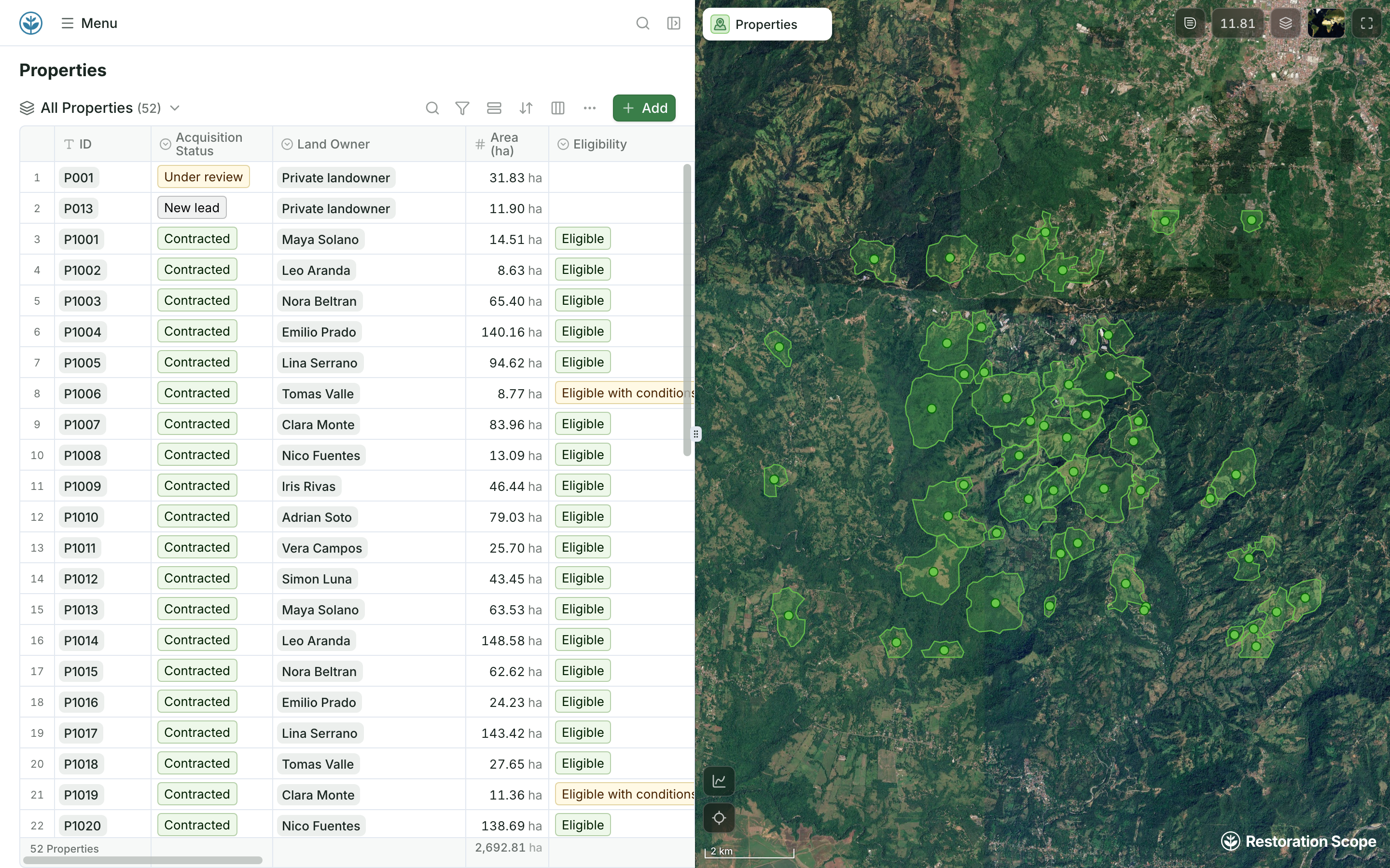
Records sit beside their boundaries on the map, with acquisition status, area and eligibility.
Restoration Scope is built around sites and boundaries on a map, with a field app that works offline, configured with you around the project. Airtable is a database that feels like a spreadsheet: linked records, interfaces, forms and automations that teams build themselves. Maps are its weak spot: a Map extension drops pins from an address or coordinates text field, using your own Google Maps API key.
 Restoration Scope
For most nature restoration and carbon projects, Restoration Scope: every parcel, plot and planting has its boundary on a map, field teams work offline, and the system is configured with you rather than built as a base yourself. Airtable suits a team that wants to design and change its own database for lists, pipelines and approvals, and is always online.
Restoration Scope publishes this comparison and is one of the options. We list it first because we think it's the best fit for most projects: it adapts to each project and grows with it, and covers operations and costs as well as fundraising and reporting. No vendor paid to be included. Something out of date? Write to info@restorationscope.com.
| Restoration Scope |  Airtable | |
|---|---|---|
| What it is | The system that runs a nature project: sites, field work, surveys, maps, results and funder reporting. The field app and its surveys are part of it. | A no-code database: tables with linked records, plus interfaces, forms and automations that teams build themselves. |
| Cost | A free pilot on a sample of your data, then a platform license plus implementation, quoted after a scoping call. | As of October 2026: Airtable has a free plan for small bases; Team is $20 and Business $45 per paid seat a month billed yearly. Nonprofits can apply for 50% off Team on monthly billing, $12 a seat a month. |
| Linked records | Sites, plots, nurseries, species and visits are linked records, configured for your project with our team. | Its strength: link sites to visits, species and partners, with lookups and rollups, in a structure you design and maintain. |
| Maps | Sites, boundaries and records on one project map, with geospatial data layers. | No built-in map view or interface layout. The Map extension, on paid plans, plots records as pins from an address or coordinates text field and needs your own Google Maps API key. Its help page describes pins, not boundaries. |
| Boundaries and GIS files | Points, lines and polygons drawn or walked on the project map, saved to their site. Shapefile, GeoJSON, KML and KMZ files come in and attach to their sites. | No field type for shapes. Boundaries are kept as text or attached KML, GeoJSON or shapefiles; checking that they are valid takes custom scripts. |
| Field capture | Restoration Scope Field works offline: points, lines, polygons and photos. | Forms and mobile apps need a connection: Airtable says offline access is not supported. |
| Photos | Attached to the record, with place and time. | Attachments on the record, with 20 GB per base on Team. The Map extension plots records, not where each photo was taken. |
| Funder reporting | Donor portals built from the same records the team keeps. | Interfaces and shared views that you design. Interface layouts include list, gallery, kanban, calendar and timeline; none is a map. A map takes a custom interface element, built with its extensions SDK. |
Checked against Airtable's own pages on October 18, 2026: Pricing, Plans and limits, Nonprofit plans, Map extension, Interface Designer, Offline access.
These are Restoration Scope screens from our demo project and a public donor portal. To see Airtable, visit its own site.
Records sit beside their boundaries on the map, with acquisition status, area and eligibility.
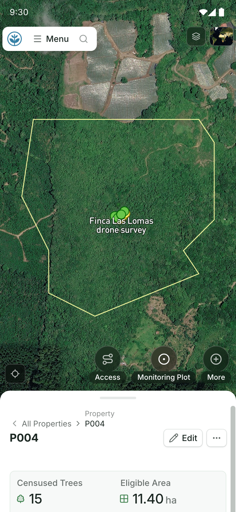
A boundary drawn or walked in Restoration Scope Field, with or without signal, is saved to the site it belongs to, with its area.
Airtable links records, forms and interfaces; its map is a pins-only extension, and hierarchies such as project, site, plot and tree are linked tables you build. Restoration Scope is an adaptable platform with maps and linked sites, plots and visits built in.
Where restoration records live, from word of mouth to custom softwareFor nature restoration and carbon projects whose records live on a map, yes. For general databases a team designs itself, such as grant pipelines or contact lists, Airtable is the more flexible tool.
Not as a built-in view or interface layout. The Map extension, on paid plans, plots records as pins from an address or coordinates text field. It needs your own Google Maps API key, with billing turned on in Google Cloud. Its help page describes pins, not boundaries.
As of October 2026, up to 1,000 per base on the free plan, 50,000 on Team and 125,000 on Business (self-serve). Tree-level monitoring over several seasons can reach these limits.
Yes. Airtable exports each table as a CSV file, and those come into Restoration Scope as spreadsheet imports. We map the fields and links to your project during setup.
Another question? Email us or book a call.
Bring in the spreadsheets, field forms and maps you already use, and see every site in one place.