


Restoration Scope
for Carbon Projects

Carbon projects, connected from land to field. Bring land acquisition, field operations and monitoring into one place. Restoration Scope connects your records and maps in software configured around the way your project works.

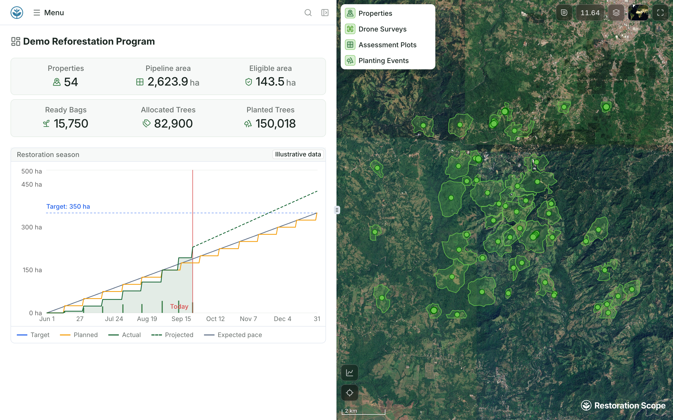
Demo project dashboard: 54 properties in the land pipeline, eligible area, seedlings and planted trees, and the restoration season chart beside the properties map

Built with teams restoring landscapes

What can your carbon project team do with Restoration Scope?

Connect the decisions made in the office with the work happening on the ground.

Living Carbon map of Arkansas property boundaries on satellite imagery: one selected property outlined in white, a neighbouring parcel in green where the same owner has enough plantable land, other property lines in red
The selected parcel's card (owner and parcel id are stand-ins): not public, 117 plantable acres, 478 plantable acres held by the same owner within a mile, a 472-acre touching same-owner block

Bring land acquisition and eligibility into one view.

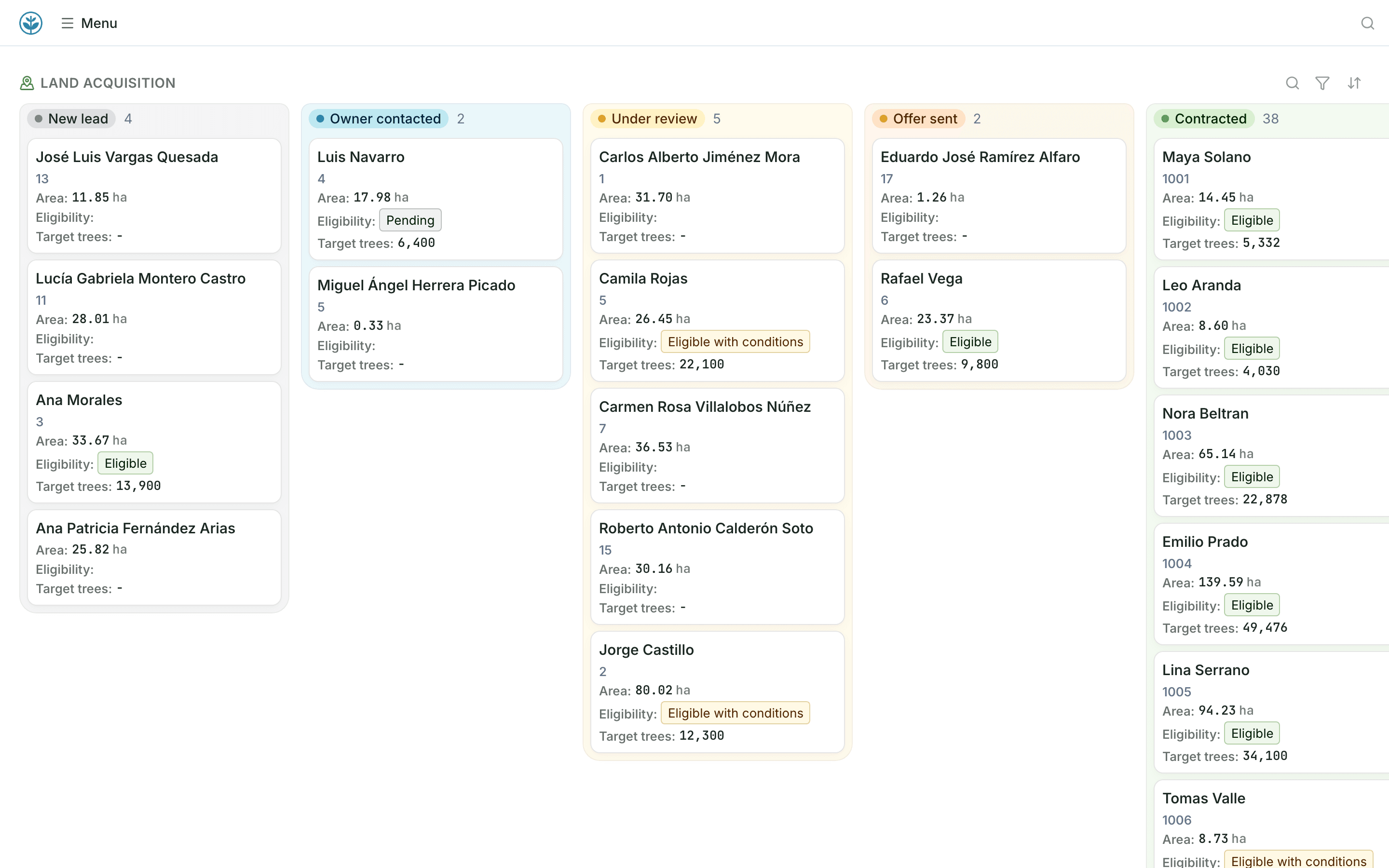
Review property boundaries, land cover and plantable area alongside landowner records. Move each property through conversations, assessment and contracting with a pipeline configured for your team.
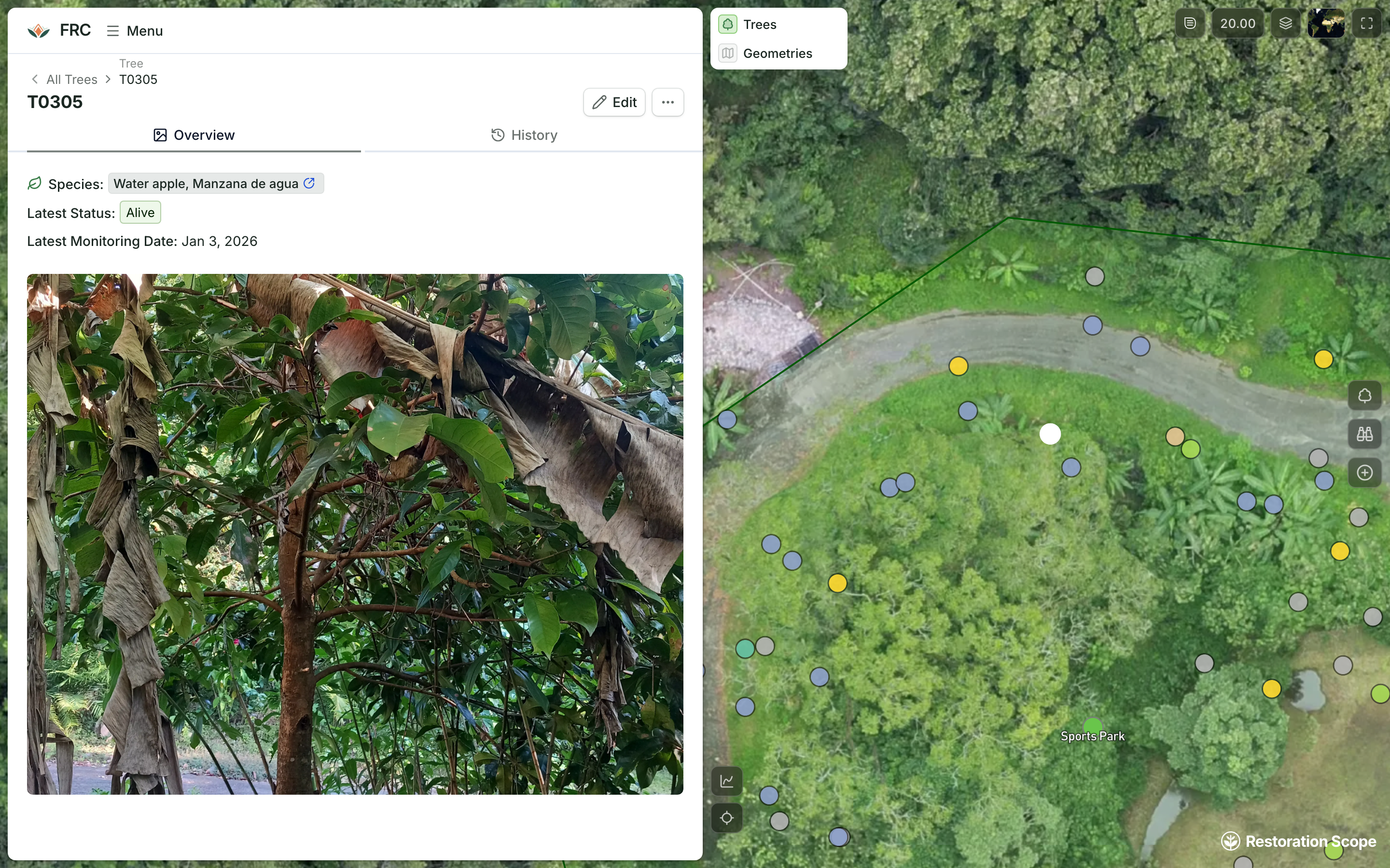
Alegría FRC tree T0305: its field photo, species and latest status beside the drone image of the site with every tree as a point
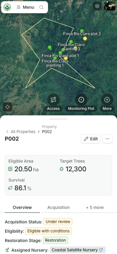
Property record and project status on a phone

Connect the field to the people planning the work.

See drone baselines, field photos and survey records in their geographic context. Draw planting areas, coordinate activities and give field teams access to the same property information on mobile.

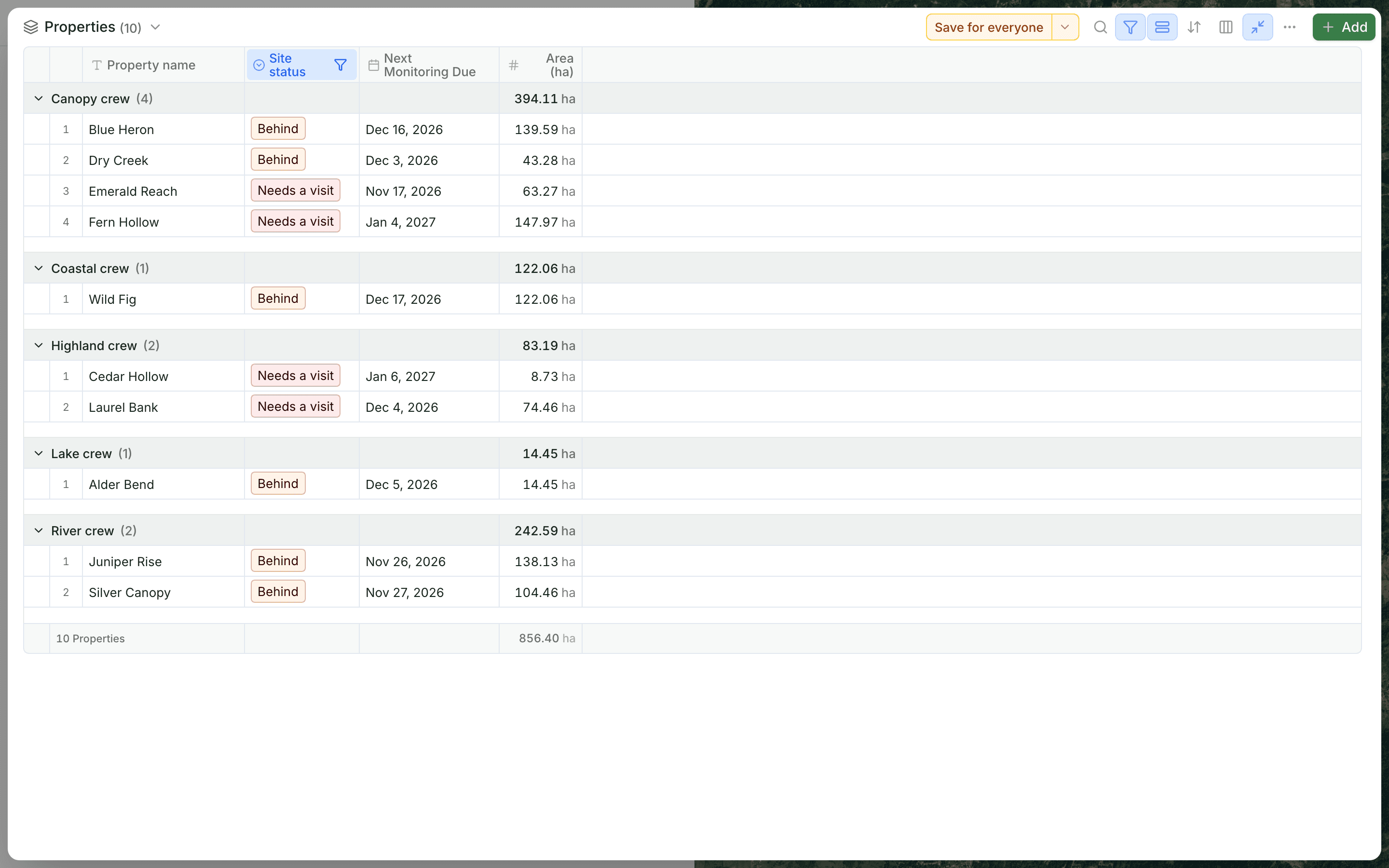
Demo sites that are behind or need a visit, grouped by field crew, with each site’s next monitoring date

Keep monitoring connected to daily operations.

Follow plots, trees and maintenance tasks over time. Bring repeated observations and assigned work into the same system, so your team can review progress and trace the records behind it.

Your project data, brought together.

Connect the tools, field records and geospatial sources your team already uses.

KoboToolbox
Google Sheets
Excel
QGIS
ArcGIS
Earth Engine
More connections
Explore data connections

Which standard are you working toward?

Each standard asks for different field records. Start with the one your project follows.

Questions from carbon project teams

Can we start with one part of the project?

Yes. Start with acquisition, field capture or monitoring, then extend the system as the project develops.

How does Restoration Scope Field fit in?

Field teams can work with property maps and capture records on mobile. Records and permissions follow their role and connect to the wider team’s workflows.

How is the software configured for our project?

We work with your team to define the records, workflow stages, maps, permissions and data connections around your operating process.

Does Restoration Scope work with Verra, Gold Standard and Plan Vivo projects?

Yes. The standard and its methodology decide what you measure; Restoration Scope holds those records. Your team configures the plots, trees, planting events and monitoring visits your methodology asks for.

Can we keep a tree-by-tree census for VM0047?

Yes. Each tree can carry its own ID, species, GPS point, photos and monitoring visits, captured offline in the field. Tables export as CSV for your verifier.

Does Restoration Scope issue or verify carbon credits?

No. Standards issue credits and independent verifiers check them. Restoration Scope keeps the project record they review.

Another question? Email us or book a call.

Updated

Connect your data, understand your operations.

Bring in the spreadsheets, field forms and maps you already use, and see every site in one place.