EN
Tools for EUDR Geolocation Data, From Field Mapping to Filing
The tool for each EUDR geolocation step: map plots offline (KoboToolbox, ODK, QField), fix GeoJSON (GeoRoots), screen for deforestation (Whisp), file in TRACES.
The EU Deforestation Regulation asks a simple-sounding question about every bag of coffee or cocoa: which plots did it come from? Answering it means mapping thousands of small farms, checking each one against the forest as it was at the end of 2020, and filing the result in a format the EU's system accepts. No single tool does all of that for everyone.
This guide lists the tools for each step, with who each one fits. It's written for cooperatives, exporters and the teams doing due diligence for them. It's an editorial shortlist with our recommendation, not legal advice.
Which tools help at each step?
For most cooperatives and exporters with field teams, we recommend Restoration Scope: it keeps plots, producers and repeat visits together and prepares each lot's geolocation file. For mapping alone, KoboToolbox or QField may be enough. GeoRoots helps fix files, Whisp screens for deforestation, and the EU Information System receives the statement, which your team reviews and files.
Disclosure: Restoration Scope publishes this guide and is one of the options below. We list it first because we think it's the best fit for most projects: it adapts to each project and grows with it, and covers operations and costs as well as fundraising and reporting. No vendor paid to be listed, and there are no affiliate links.
| Step | Restoration Scope | Free options | Other paid options |
|---|---|---|---|
| Map plots in the field | Restoration Scope Field, offline | KoboToolbox, ODK, QField, Mergin Maps, Open Foris Ground, WHIMO | ArcGIS Field Maps, Koltiva, Farmforce, TraceX |
| Check and fix the GeoJSON | Lists plots not mapped yet, points used for plots over 4 ha and areas that differ from the declared one | GeoRoots, our  EUDR plot file checker, the Information System's upload check | Most paid platforms |
| Screen for deforestation | 2020 forest maps and alerts your team reviews | Whisp, Global Nature Watch, JRC IMPACT Toolbox | Satelligence, Meridia, Koltiva, TraceX |
| File the statement | Prepares each lot's geolocation file; you file | EU Information System (TRACES) | Satelligence, TraceX, ICE CoT |
Where Restoration Scope fits: for most programmes that run their own field teams, we think Restoration Scope, a plot mapping and field data platform for cooperatives and exporters, is the best fit. It adapts to how you work and grows with your supply base, and it keeps each plot linked to its producer and its visits in one place, so the same records run the field work and answer buyers. Field teams walk a boundary again offline in Restoration Scope Field, the office reviews it over the 2020 forest maps, and each boundary downloads as GeoJSON or KML to check before filing. Restoration Scope doesn't give a compliance verdict or file statements. More on where Restoration Scope fits.
Checked October 24, 2026: rules come from the regulation on EUR-Lex, the Commission's FAQ and the Information System's GeoJSON description. Tool claims come from each tool's own website or documentation, linked under each entry. We didn't test the paid platforms.
What geolocation data does the EUDR require?
- Coordinates with at least six decimals for every plot where the commodity was produced (Art. 2(28)).
- A point or a polygon for plots of 4 hectares or less; a polygon for anything larger. One polygon per plot; no centre point with a radius.
- The cutoff date is 31 December 2020. Land deforested after that date doesn't qualify.
- GeoJSON in WGS84, longitude first, if you upload a file (
GeoJSON file description).
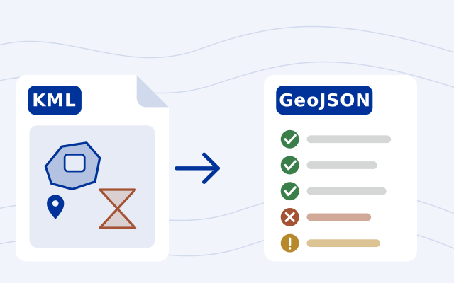
The file description has rules that catch people out. A point without an Area property is treated as 4 hectares. An area written as text, like "3", is read as zero. The system cuts coordinates to six decimals, which can turn two close vertices into a duplicate and make the polygon invalid. Polygons with holes, self-crossing edges and open rings are rejected. Our free EUDR plot file checker finds each of these, fixes the ones it safely can and explains every fix.
The Commission's FAQ also says the operator is responsible for the accuracy of the data, whoever collected it.
When does the EUDR apply?
Regulation (EU) 2025/2650 moved the dates again (EUR-Lex):
- 30 December 2026 for large and medium operators.
- 30 June 2027 for micro and small operators, including natural persons, established as such by the end of 2024, except for products from the old EU Timber Regulation, which keep 30 December 2026.
- Soluble coffee joins the scope from 30 December 2027 (
Delegated Regulation 2026/2102). Green coffee is already in.
Eligible micro and small primary operators in low-risk countries can give postal addresses that identify the plots instead of coordinates. Most coffee and cocoa origins, including Brazil, Colombia, Peru, Côte d'Ivoire and Ethiopia, are standard risk on the 2025 country list, so they still need plots. Our EUDR explainer has the full timeline and who files the due diligence statement.
Where does Restoration Scope fit?
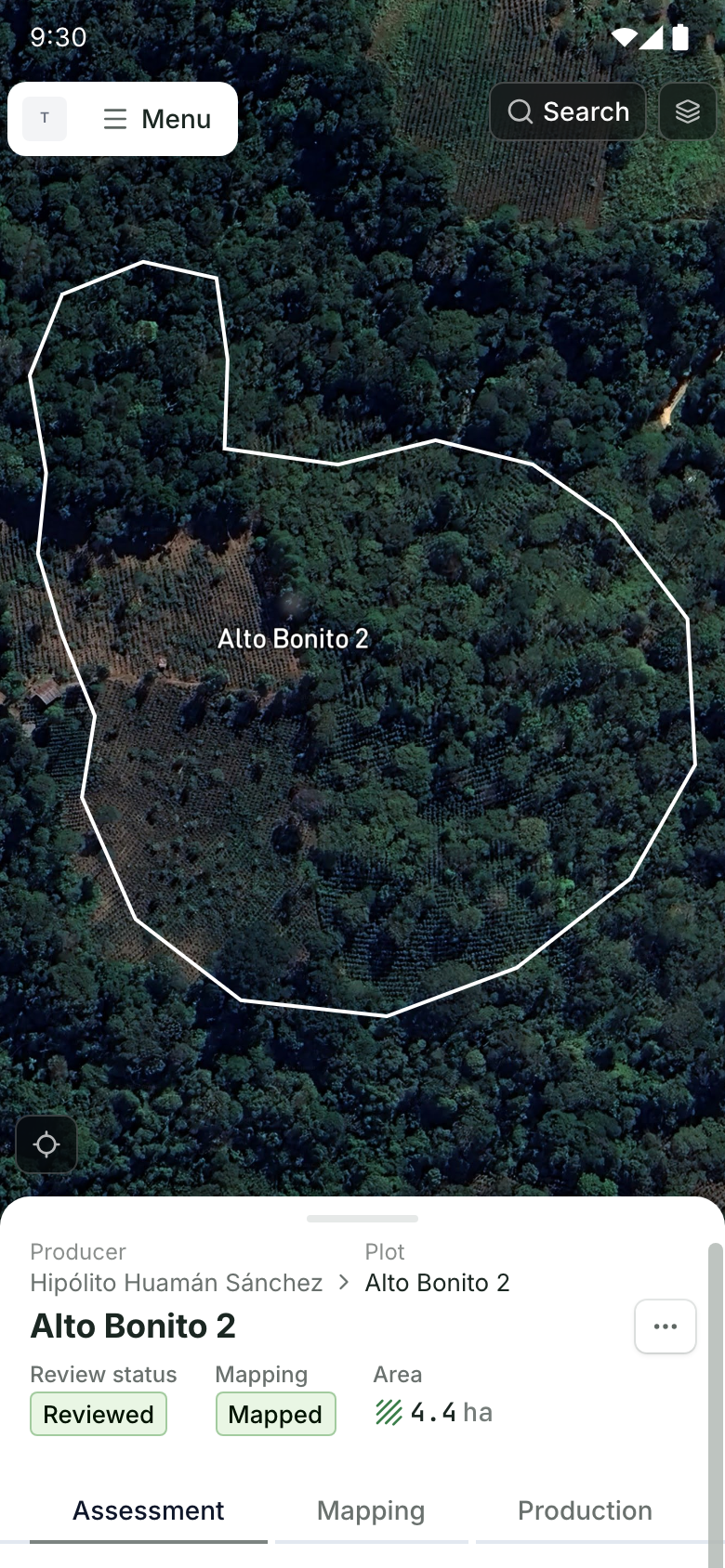
Restoration Scope is a plot mapping and field data platform for cooperatives and exporters preparing EUDR plot data. It keeps one record per plot, linked to its producer, mapped as a boundary or a point. You can view plots over the JRC 2020 forest layers and recent disturbance alerts, and follow plots that need a closer look. Field teams open a plot on their phones, walk the boundary again offline, and record the visit, so the next statement starts from what's on the ground. Each plot's boundary downloads as GeoJSON or KML; check it in GeoRoots or our plot file checker before filing.
If your plot list lives in spreadsheets, field forms and GeoJSON files, a short call is the quickest way to see whether we fit. We'll look at how you map and update plots today, what your buyers ask for, and which tools above you already use. If a free field app and GeoRoots are enough, we'll say so. If not, we'll show how your plots, producers and field visits would look in one place. Book a call.

Plots that need a closer look.
A plot over the JRC Global Forest Cover 2020 layer, beside its due diligence checklist and an open risk case with a field visit scheduled. Field teams open another plot on their phones: its boundary on the map and its record below. Demo cooperative: producers, plot records, risk cases and field visits are made up, and deforestation statuses, check results and cutoff figures are not computed by Restoration Scope. Plot locations, map layers and imagery are real.
Good fit: most cooperatives and exporters that run field teams and want plots, producers and visits kept current in one system that adapts to them as they grow, set up with them.
Think twice if: you only need to file a few statements, or you want a verdict on each plot. We don't run an automatic cutoff check, give a compliance verdict or file statements; pair us with Whisp and the Information System, or choose a platform above.
Cost: a free pilot on a sample of your data, then a platform license plus implementation, quoted after a scoping call.
Which apps map plot boundaries in the field?
Most apps below record polygons, and all of them work offline once forms, projects or maps are prepared on the device.
- Restoration Scope Field: our pick for programmes that keep plot boundaries, producers and repeat visits together. Walk or tap a boundary offline, with a warning when GPS accuracy is weak; each boundary downloads as GeoJSON or KML. We set up the project's records and checks with you.
KoboToolbox: polygon questions and a built-in GeoJSON export. Free for nonprofits; companies pay (pricing).
ODK: records a boundary by tapping or by logging GPS points as you walk, with an accuracy limit. Exports GeoJSON from ODK Central. Free to self-host; ODK Cloud from $199 a month, billed annually.
QField: free, open-source mapping from QGIS projects. Best when someone can own the QGIS project; files are exported through QGIS.
Mergin Maps: QGIS-based, offline, with an EUDR guide and external GNSS support. From €15.8 per contributor a month billed annually; free for nonprofits with income under $30,000.
ArcGIS Field Maps: for teams already on ArcGIS. Offline needs a sync-enabled layer and prepared map areas; GeoJSON comes out through ArcGIS Online or Pro.
Open Foris Ground (FAO and Google) and
WHIMO (European Forest Institute): free, open-source apps aimed at smallholder supply chains. WHIMO imports existing farm polygons and records points rather than walking new boundaries.
Whatever the app, walking a boundary with a phone produces errors: a few metres of drift under trees, crossing lines, duplicate points. Check each phone on site with a GPS accuracy test, and plan to clean the file before filing.
Which free tools check and screen plots?
GeoRoots is a set of free, open-source browser tools for EUDR GeoJSON: turn a spreadsheet into a file, edit and check shapes, rename properties to the EU format, merge, split and remove duplicates. It runs locally, so the data doesn't leave your computer. Its editor was built with the European Forest Institute. It doesn't claim to run exactly the same checks as the Information System.
EUDR plot file checker is our free browser tool. It reads KML, shapefiles, GeoJSON or a spreadsheet of coordinates and returns a GeoJSON in the EU's format. It makes the fixes it safely can, such as areas written as text, open rings and corners that repeat once rounded to six decimals, explains each one, and flags the rest. Self-crossing boundaries are marked on the map, where you can drag a corner back to where the boundary really is. The file stays in your browser. It checks the file only, not deforestation or legality.
Whisp, from FAO and the Forest Data Partnership, compares each plot with many land-cover, commodity and disturbance datasets and returns a risk flag per plot, with a separate flag for perennial crops like coffee and cocoa. The web app takes up to 10,000 plots per job; there's also an API, a Python package and a QGIS plugin (
GitHub). It screens; it doesn't collect plots or file statements. Our Whisp guide walks through a run and what to do with a flagged plot.
Global Nature Watch is the new name for Global Forest Watch. One date matters: GFW Pro, which many teams use for EUDR checks, shuts down on 31 December 2026, and its data is deleted afterwards (
notice). WRI points cooperatives to its free Horizon tool, where an EUDR risk check is announced but not yet live.
About the EU's forest map. The JRC Global Forest Cover 2020 map on the EU Observatory is a useful reference, but the Commission's FAQ calls it non-mandatory and not a definitive source for compliance. It also leaves coffee and cocoa plantations out of "forest".
The European Forest Institute keeps an up-to-date list of free EUDR tools, worth checking for newer options.
Which platforms handle the whole due diligence workflow?
Paid platforms join collection, checks, risk screening and sometimes filing. None of these publishes prices; claims about the others are their own.
- Restoration Scope: our pick for most cooperatives and exporters that run field teams: plots, producers and field visits in one system that adapts to the programme, with offline mapping and the 2020 forest maps. You file the statement.
Satelligence: satellite monitoring and traceability for large buyers, with filing "directly to TRACES". No field app described.
Meridia Verify: data-quality and risk checks for traders, priced by hectares checked per year (from 50,000). It hands data to
ICE's traceability service, which files statements for coffee and cocoa.
Koltiva KoltiTrace: farmer registration with offline plot mapping, deforestation checks and statement filing, for cooperatives, processors and exporters.
Farmforce: smallholder farm management with offline polygon mapping, overlap and duplicate checks.
TraceX: offline field app, shape checks, screening against 2020 forest data and statement preparation.
How do you choose EUDR geolocation tools?
- Start from your volume. A few hundred plots can go from a free field app through GeoRoots into the Information System by hand. Tens of thousands of plots across many suppliers justify a platform.
- Decide who owns the plot list. EUDR is not a one-off mapping exercise: plots change hands, boundaries move and farms get replanted. Pick the tool your field team can keep updating.
- Check the file before the deadline. Run a sample with real polygons and points through GeoRoots and the Information System's upload check, and fix what they reject.
- Screen with more than one source. The EU map isn't conclusive. A second source such as Whisp, plus imagery from before and after 2020, makes a flagged plot easier to clear or confirm. Our free EUDR plot viewer shows each plot in late 2020 and in the last six months, side by side.
- Plan for GFW Pro's shutdown. If your process depends on it, move before 31 December 2026.
For choosing a field app in more depth, see our guide to field-data apps. To convert coordinates from UTM, use the free UTM to lat/long converter; for WKT boundaries, the WKT to GeoJSON converter.
Learn everything about the EUDR
From what the regulation asks to mapping plots, tracing lots and reviewing the evidence, in the order teams need it.
Map every plot
- EUDR for cooperatives
- What geolocation the EUDR requires
- Tools for EUDR geolocation dataYou’re reading this
- Free toolField plot template
- Free toolPlot file checker
- ProductMapping plots in Restoration Scope
Trace each lot to its plotsUp next
Frequently asked questions
When does the EUDR apply?
The rules apply from 30 December 2026. Qualifying micro and small operators, including natural persons, established as such by 31 December 2024 have until 30 June 2027, except for products from the old EU Timber Regulation. Traders and downstream operators follow the December 2026 date. The dates come from Regulation (EU) 2025/2650.
Does every coffee or cocoa plot need a polygon?
No. Plots of 4 hectares or less can be a single point; plots larger than 4 hectares need a polygon. Coordinates need at least six decimal places, and each polygon should describe one plot.
What file format does the EU Information System accept?
GeoJSON in WGS84 (EPSG:4326), with longitude before latitude, or plots entered by hand. The EUDR plot file checker tests a file against these rules. A due diligence statement can be up to 25 MB including its geolocation. The system rejects polygons with holes, self-crossing shapes and open rings.
Is the JRC Global Forest Cover 2020 map required for EUDR checks?
No. The Commission's FAQ calls the EU Observatory maps non-mandatory and non-legally binding. A plot inside mapped forest is not automatically non-compliant, and a plot outside it is not automatically compliant.
What free tools can check EUDR plots for deforestation?
Whisp, from FAO and the Forest Data Partnership, screens plots against many datasets and returns a risk flag per plot. The Commission's FAQ names Whisp, the JRC IMPACT Toolbox and GFW Pro, but GFW Pro shuts down on 31 December 2026.
Can a cooperative do EUDR geolocation without paid software?
Often, yes. A free field app such as KoboToolbox, ODK or QField can map plots, GeoRoots can check and fix the GeoJSON, Whisp can screen for deforestation risk, and statements are filed in the EU Information System. The cost is the people who keep the plot list current.
Another question? Email us or book a call.
Based on the official EU texts. See our EUDR sources, with the version we follow and the day we last checked each one.