What Geolocation Does the EUDR Require?
The EUDR asks for every plot a product came from: a point with six decimals, or a polygon above 4 hectares. What that means in a GeoJSON file.
The EU Deforestation Regulation (EUDR) requires the location of every plot of land where a covered commodity was produced: at least one latitude and longitude point with six decimal places, or a polygon around the plot when it is larger than 4 hectares. Operators upload these locations as GeoJSON with their due diligence statement, to show the land was not deforested after 31 December 2020. Micro and small primary operators in low-risk countries can use a simplified declaration with a postal address instead.
The rules below are summarized from the regulation, the Commission's FAQ and the EU's GeoJSON file description, as they stood in October 2026. Check the official EUDR guidance before relying on them.
What does the EUDR mean by geolocation?
The regulation defines it in Article 2(28): the location of a plot of land, described by latitude and longitude, with at least one point and at least six decimal digits. For plots of more than 4 hectares used to produce the commodity (other than cattle), the location has to be a polygon with enough points to describe the plot's perimeter.
A few terms do most of the work:
- Plot of land: land within one property with conditions similar enough to assess as one. It can be the whole property or only the part that is farmed.
- Cut-off date: 31 December 2020. Products must come from land that was not deforested after it.
- Commodities: cattle, cocoa, coffee, oil palm, rubber, soya and wood, and products made from them.
The obligations generally apply from 30 December 2026. Micro and small operators, including natural persons, established as such by 31 December 2024 have until 30 June 2027, except for products covered by the old EU Timber Regulation. Our EUDR explainer covers who files the due diligence statement and the full timeline.
When do you need a point and when a polygon?
4 hectares or less
- One point
- A polygon, which shows the whole plot
More than 4 hectares
- A polygon around the plot
- A single point
Cattle
- A point for each establishment where the animals were kept
Four hectares is a square of 200 by 200 metres. Many coffee and cocoa farms are smaller, so a single point is often allowed. A polygon still says more: it shows the whole plot, which is what a deforestation check compares against forest maps.
Each polygon is one plot. A farmer with three separate plots needs three locations, not one shape drawn around all of them.
- One shape around three plots
- Three plots, three shapes
Why six decimal places?
Six decimal places is about 11 centimetres of latitude, and less of longitude away from the equator. The rule is about not losing precision when coordinates are copied or rounded, not about how accurate the measurement is.
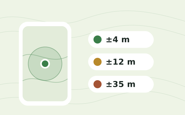
A phone recording the point is still accurate to 3 to 10 metres, whatever the number of digits. Our explainer on phone GPS accuracy covers what to expect in the field. Padding a rounded coordinate with zeros meets the format and adds nothing: -6.48 written as -6.480000 is still only accurate to about half a kilometre.
What does an EUDR GeoJSON file look like?
The EU's information system takes GeoJSON uploads, in WGS84 longitude and latitude, longitude first, and plots can also be entered by hand. Here is one small plot as a point and one larger plot as a polygon, with the optional properties the EU format reads:
{
  "type": "FeatureCollection",
  "features": [
    {
      "type": "Feature",
      "properties": { "ProductionPlace": "Plot 1", "ProducerCountry": "PE", "Area": 1.5 },
      "geometry": { "type": "Point", "coordinates": [-76.365312, -6.482541] }
    },
    {
      "type": "Feature",
      "properties": { "ProductionPlace": "Plot 2", "ProducerCountry": "PE" },
      "geometry": {
        "type": "Polygon",
        "coordinates": [[
          [-76.372410, -6.490120], [-76.369705, -6.490120], [-76.369705, -6.487405],
          [-76.372410, -6.487405], [-76.372410, -6.490120]
        ]]
      }
    }
  ]
}
The second plot is about 9 hectares, so it needs the polygon. The rules from the EUDR GeoJSON file description:
- Accepted shapes: Point, MultiPoint, Polygon and MultiPolygon. Lines are rejected.
- Polygons must be clean: closed rings, no holes, no edges that cross each other.
- Properties are case-sensitive:
ProductionPlace,ProducerName,ProducerCountry(two-letter country code) andArea(hectares, for points).Areamust be a number: written as text, such as"3", it is read as 0. - A point without
Areacounts as 4 hectares. - Size: up to 25 MB per statement, including the geolocation.
What usually goes wrong with EUDR plot data?
The same things that go wrong with any field location data, now with a deadline:
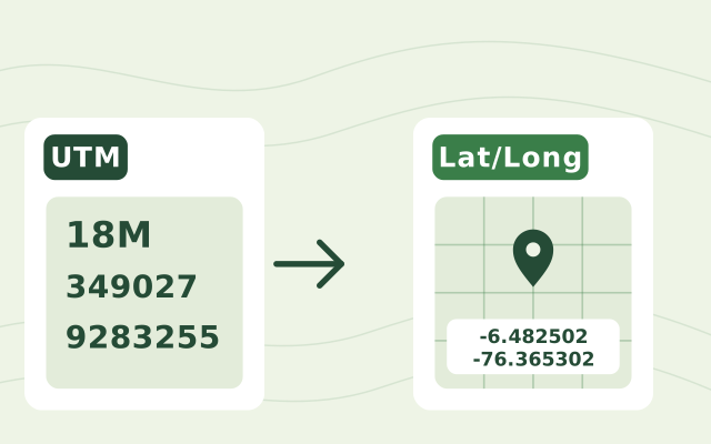
- Coordinates in another system. Many land records and older surveys use UTM or a national grid. The EUDR needs latitude and longitude, so convert them first. The
 UTM to Lat/Long Converter assumes WGS84, so records in an older datum need a datum change too. Our explainer on UTM coordinates covers zones and the old datums that shift points by hundreds of metres.
- Latitude and longitude swapped. GeoJSON is longitude first. A swapped plot lands in the wrong place, often far away.
- Shapes that cross themselves. A boundary walked with a phone can loop back over itself where the GPS wandered. The system rejects it; redraw or simplify that stretch.
- Points too close together. Cutting coordinates to six decimals can turn two nearly identical vertices into duplicates and make the polygon invalid.
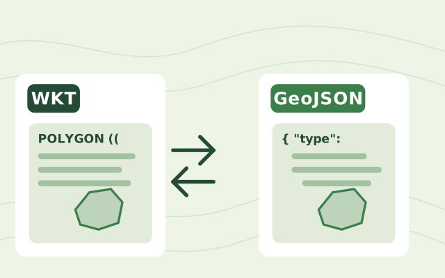
- Boundaries stored as text. Plots kept as WKT in a spreadsheet or exported from a database need converting. WKT vs GeoJSON explains the difference.
How do you prepare plot locations for the EUDR?
- List every plot a product could come from, with an ID, the producer and the country.
- Decide point or polygon for each plot by its size: a polygon above 4 hectares.
- Collect the location in latitude and longitude. Walk the boundary with a phone, draw it on satellite imagery, or convert existing records. Test your phones on site with the GPS Accuracy Test before the walk.
- Convert to GeoJSON. Our WKT to GeoJSON Converter turns WKT or a list of coordinates into a GeoJSON geometry and draws it on a map. Wrap each geometry in a Feature inside a FeatureCollection, and add
ProductionPlace,ProducerCountryandAreabefore upload. - Check the shapes on a map against satellite imagery: each in the right place, closed and not crossing itself.
The geolocation shows where a product came from. Whether that land was deforested after 2020 is a separate check, which operators make against satellite data and forest maps as part of their due diligence. For the software that helps with both, see our guide to EUDR geolocation tools.
Learn everything about the EUDR
From what the regulation asks to mapping plots, tracing lots and reviewing the evidence, in the order teams need it.
Map every plot
- EUDR for cooperatives
- What geolocation the EUDR requiresYou’re reading this
- Tools for EUDR geolocation data
- Free toolField plot template
- Free toolPlot file checker
- ProductMapping plots in Restoration Scope
Trace each lot to its plotsUp next
Frequently asked questions
How many decimal places does the EUDR require?
At least six for latitude and longitude. Six decimal places is about 11 centimetres of latitude, far finer than a phone's GPS, so the digits do not make a point accurate. The EU system cuts coordinates to six decimals and pads shorter ones with zeros.
When is a polygon required instead of a point?
For plots of more than 4 hectares used to produce the commodity, except for cattle. A plot of 4 hectares or less can be a single point or a polygon.
What coordinate system does the EUDR use?
WGS84 (EPSG:4326), the latitude and longitude system GPS uses, written in GeoJSON with longitude first. UTM or national coordinates must be converted before upload, for example with the UTM to lat/long converter.
Can one polygon cover several farms?
No. Each polygon describes one plot of land. Several plots can go in one file as separate features or as a MultiPolygon.
What happens if a point has no area?
In the EU's GeoJSON format, a point can carry an Area property in hectares. If it is missing, the system assumes 4 hectares.
Another question? Email us or book a call.
Based on the official EU texts. See our EUDR sources, with the version we follow and the day we last checked each one.