Download polygons from the map
Download every polygon of a map layer, or only the filtered ones, as a .geojson or .kml file.
You can download every polygon of a map layer in one file, as .geojson or .kml. If you filter the table first, the file for that layer holds only the polygons left on the map. Use a computer: the layer's ⋯ button appears when you point at the layer in the legend.
Download every polygon of a layer
- Open the page with the map.
- In the map's legend, hover over the layer (for example, Sites) and click ⋯.
- Choose Download, then Download .geojson or Download .kml.
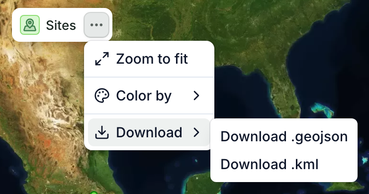
You get one file with every polygon of that layer.
Download only some polygons
When a table and a map are on the same page, the map layer that shows the same records as the table shares its filter: what you filter out of the table also leaves that layer, and its download holds only what is left. Other layers keep all their polygons.
- In the table, click Filter and add the condition you need, for example only the sites whose Status is Planted.
- Check the map: the Sites layer now shows only those sites. To zoom to them, open the layer's ⋯ menu and choose Zoom to fit.
- In the same ⋯ menu, choose Download and the format.
You can also filter from the map: in the layer's ⋯ menu, Filter opens the same filter as the table.
To download every polygon again, remove the filter before you download.
A layer without polygons downloads what it shows instead: its lines, or else its points.
Which format to choose
- .kml: opens straight in Google Earth.
- .geojson: opens in QGIS, ArcGIS and most GIS software. If you need a Shapefile, open the .geojson in QGIS and export it as a Shapefile.
To get the file ready for an EUDR statement or a carbon verifier, see Prepare boundaries for the EUDR or a verifier.